|
Dr. Arthur Busbey Geology Program |
|
|
Dr. Arthur Busbey Geology Program |
I was born in the Panama Canal Zone during the early years of I Love Lucy. I have B.S. (1975) and M.A. (1977) degrees in Geology from the University of Texas at Austin and a Ph.D. (1982) in Anatomy from the University of Chicago. I taught as a lecturer in geology at the University of Texas at Austin from 1982 to 1985 and have been at TCU since 1985. I have team-conducted a number of EOSAT-sponsored image processing/geology workshops here at TCU, using our computer facilities. With others I have conducted microcomputer image processing workshops for ERIM and also at ECOINFORMA meetings. On the fun side, I have consulted with the Lincoln Park Zoo in Chicago and the Gladys Porter Zoo in Brownsville about fossil reptile dioramas and murals. I have been a judge in the Tarrant County Science Fair for a number of years, have twice judged at the International Science Fair and given talks to the public on various aspects of geology and paleontology.
I was in the introductory show of the third season of Paleoworld (originally shown on The Learning Channel) in an episode on giant crocodilians, with Wann Langston and Chris Brochu from U.T. Austin. In 1996 Paul Willis, Robert Coenaads and David Roots and I published a Nature Company fieldguide, Rocks and Fossils. It did very well and is, unfortunately, now out of print and has become rather rare.
For a number of years I wrote the MacColumn for Geobyte (a publication of the American Association of Petroleum Geologists) the Software Column for Geotimes (published by the American Geological Institute), concentrating on Macintosh geological software. I write computer applications and use the following languages when necessary - BASIC, FORTRAN, PASCAL, C and various scripting languages (including AppleScript). See my 'casual' page for more likes about computers (don't look there if you expect me to say anything nice about Wintel boat anchors because you would be wasting your time - it is bad enough that I have to support these byzantine bloated nightmares). I like Macs and UNIX (I use it in OsX, on our OsX servers and used to use Solaris on SUNs). For boring details about research and publications just see below.
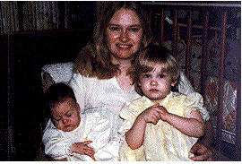 |
I married Janet Busbey Nilsson in 1977 and we have two daughters, Saramae (born 1979) and Laralen (born 1981). Janet has two B.S. degrees (Geology and Zoology from U.T.-Austin), a Masters of Liberal Arts from TCU, and keeps busy teaching 8th grade science. Sara graduated from Rice University in the summer of 2002 with a degree in English. Lara has traveled widely across the country and now lives in Fort Worth where she does volunteer work for the Humane Society. Janet and I are members of the Board of the Laura Ingalls Wilder Foundation, which maintains the house (Rocky Ridge in Mansfield, Missouri) that Laura Ingalls Wilder and her husband Almanzo lived in for most of their life. |
|
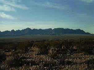
The Chisos Mountains, Big Bend National Park, from the Rosillos Ranch. |
Current research areas
|
Refereed publications:
Busbey, A. B. and Gow, C. (1984) A new protosuchian crocodile from the Upper Triassic Elliot Formation of South Africa. Palaeontologica Africana 25:127-149.
Busbey, A. B. (1986) Pristichampsus cf. P. vorax (Eusuchia:Pristichampsinae) from the Uintan of West Texas. Journal of Vertebrate Paleontology 6(1):101-103.
Busbey, A. B. (1986) New material of Sebecus cf. huilensis (Crocodilia: Sebecosuchidae) from the Miocene La Venta Formation of Colombia. Journal of Vertebrate Paleontology 6(1):20-27.
Busbey, A. B. (1988) Maps and the Macintosh PICT file. Geobyte 3(2):38-43.
Busbey, A. B. (1988) Two contouring programs for the Macintosh: MacGridzo and GeoView. Geobyte 3(2):17-21.
Morgan, K., Busbey, A.B., Newland, L. (1988) Utilizing a GIS for geological exploration. National Computer Graphics Association, Proceedings of the National Computer Graphics Association, Mapping and GIS, Orlando, Florida :73-77.
Busbey, A. B. and L. Newland (1989) The networking solution at Texas Christian University. Academic Computing 3(6):34&35,42-46.
Busbey, A.B. (1989) Linear discriminant analysis in a spreadsheet. Journal of Geological Education 37:161-167.
Busbey, A.B. (1989) Form and function of the jaw musculature of Alligator mississippiensis. Journal of Morphology, 202:99-127.
R. N. Donovan, A. B. Busbey, S. S. Bridges, K. Collins, C. Ditzell, D. Jenkins, and R. Wilhelm (1991) On three outcrops of the Simpson Group in the Northwestern part of the Slick Hills, Southern Oklahoma; in Johnson, K., ed., Late Cambrian—Ordovician Geology of the Southern Midcontinent, 1989 Symposium, Oklahoma Geological Survey, Circular 92:227 p.
Breyer, J. A., Busbey, A. B., Hanson, R. E. (1991) One billion year old grazing traces from the Allamore Formation, Trans-Pecos Texas. Geological Society of America Abstracts with Programs.
Donovan, R. N. and A.B. Busbey (1991) Leatherbury's Quarry–The World's Smallest Oil Field. Arbuckle Group Core Workshop and Field Trip, Oklahoma Geological Survey, Special Publication 91-3, p. 255-258.
Morgan, K.M., A.B. Busbey, R.N. Donovan and L. Newland (1992) Image processing and GIS at TCU's Center for Remote Sensing and Energy Research. Journal of the American Society of Photogrammetric Engineers and Remote Sensing.
Wagner, F.J. Jr. and A.B. Busbey (1992) International Directory Mapping/Contouring Software - June 1992. Geobyte.
Donovan, R.N., Busbey, A.B., Elmore, R.D. and Engel, M.H. (1992) Oil in Permian Karst in the Slick Hills of Southwestern Oklahoma, Oklahoma Geological Circular 93:198-209.
Busbey, A.B., Morgan, K, and Donovan, R.N., (1992) Image processing on the Macintosh for fracture analysis. Photogrammetric Engineering and Remote Sensing.
Busbey, A.B. Morgan, K.M., Newland, L.W., (1992) Remote Sensing and Geographic Information Systems (GIS) for Environmental Date Base Management. Ecoinforma’92, abstracts, 20.
Busbey, A.B., K.M. Morgan & R.N. Donovan (1992) Image processing approaches using the Macintosh. Journal of the American Society of Photogrammetric Engineers and Remote Sensing 58(12):1665-1668.
Morgan, K.M., A.B. Busbey, R.N. Donovan & L. Newland (1992) Image processing and GIS at TCU's Center for Remote Sensing and Energy Research. Journal of the American Society of Photogrammetric Engineers and Remote Sensing 58(8):1173-1174.
Morgan, K.M., L.W. Newland, A.B. Busbey & E. Weber (1993) Using SPOT data to map impervious cover for urgan runoff predictions. Journal of Toxicological and Environmental Chemistry.
Collerain, D., K.M. Morgan, R.N. Donovan & A.B. Busbey (1993) Lithological mapping of the Arbuckle Group in the Slick Hills of Southwestern Oklahoma, utlizing GIS / remote sensing. Oklahoma Geology Notes, 53:67.
Savell, S.J., K.M. Morgan, R.N. Donovan & A.B. Busbey (1993) Using Landsat TM, a spectrometer, and a GIS for lithologic mapping in a portion of the eastern Slick Hills, Oklahoma. Oklahoma Geology Notes, 53:67.
Aniello, C.A., S.A. Lowry, K.M. Morgan, L.W. Newland & A.B. Busbey (1993) Utilizing landsat TM thermal data to map urban heat islands in Dallas/Fort Worth.
Busbey, Arthur B. (1994), Structural consequences of skull flattening in crocodilians in Functional Morphology and Vertebrate Paleontology, Cambridge University Press.
Kresic, N. A.B. Busbey and K.M. Morgan (1994) Remote sensing and neotectonic analysis of possible groundwater flow paths in Karst, American Water Resources Association.
Swindel, B., M.H. Watson, K.M. Morgan, A.B. Busbey and L. Newland (1994) Use of Landsat TM and a GIS to map micro-urban heat island changes. ERIM, Proc. Tenth Thematic Conference on Geologic Remote Sensing, San Antonio, TX, Vol. I:533-536.
Bittick, S.M., K.M. Morgan, A.B. Busbey (1994) Image processing to map alluvial fans on the Rosillos Laccolith in Brewster Co., TX, ERIM, Proc. Tenth Thematic Conference on Geologic Remote Sensing, San Antonio, TX, Vol. I:533-536.
Breyer, J.A., A.B. Busbey, R.E. Hanson, E.C. Roy III (1995) Possible new evidence for the origin of metazoans prior to 1 Ga: Sediment-filed tubes from the Mesoproterozoic Allamore Formation, Trans-Pecos Texas, Geology 23(3):269-272.
Aniello, K.M. Morgan, A. Busbey and L. Newland, (1995), Mapping Micro-Urban Heat Islands Using Landsat TM and a GIS, In Computers & Geoscience, Special Issue on Environmental Computing, Elsevier Pub, Vol 21, No.8, pp 965-969.
A.B. Busbey, K. Morgan & L. Newland (1997) The internet face to face: video conferencing, Environmental Science and Pollution Research 4(4):2.
Bittick, S., K. Morgan, A. Busbey & L. Newland (1997) Remote Sensing and Gis for Mapping Surface Materials near Big Bend National Park, Texas., Ecoinforma 97, Vol 12, Ecoinforma Press, Bayreuth, Germany, 541-544.
Busbey, A.B., J.A. Breyer and R. Hanson, 1998, Late Cretaceous volcanic activity in the Trans Pecos magmatic province, Texas. GSA Abstracts with Programs, 30(7):A178.
Busbey, A.B. (1999) Macintosh shareware/freeware earthscience software. Comp. & Geosciences 25:335-340.
Kirkland, R and A.B. Busbey (1999) Lineaments and springs in the Rosillos Mountains, Brewster County, Texas. The Compass, 74(4):118-124.
Trenc, N., Morgan, K.M., Donovan, R.N. and A. B. Busbey, (1999) Remote Sensing Analysis of SelectedTerrestrial Impact Craters and a Suspected Impact Structure in South Korea using Space Shuttle Photographs, Geologica Croatica, Voil. 52/2, p. 203-215.
Non-refereed publications
Busbey, A. B., Lambert, D., Ross, M., and Morgan, K. (1986) Geologic overview of Big Bend National Park using Landsat imagery, in Pausé, P.H. & R.G. Spears, eds.,1986 West Texas Geological Society Field Trip Guidebook to Big Bend National Park, pp.75-82.
Busbey, A. B. (1986) Implications of snout section geometry for the construction of carnivorous archosaur skulls. North American Paleontological Convention IV Abstracts. p. A8.
Busbey, A. B. (1986) Interactive microcomputer modeling of bone/muscle mechanics. North American Paleontological Convention IV Abstracts. p. A8.
Busbey, A. B. (1988) Texas Christian University: Vertebrate Paleontology, Geology, Geostatistics - and General Hacking. Wheels for the Mind, 4(2):69-71.
Busbey, A. B. (1988) The Macolumn. Geobyte 3(3):79-80.
Busbey, A. B. (1988) The Macolumn. Geobyte 3(4):51-54.
Busbey, A. B. (1989) An Eocene Caiman from the Texas Gulf Coast. Abstracts of the Annual Meeting, Society of Vertebrate Paleontology, p. 101.
Busbey, A. B. (1989) The Macolumn. Geobyte 4(1):50-52.
Busbey, A. B. (1989) The Macolumn. Geobyte 4(2):29-33.
Busbey, A. B. (1989) The Macolumn. Geobyte 4(3):48-53.
Busbey, A. B. (1989) The Macolumn. Geobyte 4(4):52-54.
Busbey, A. B. (1989) The Macolumn. Geobyte 4(5):60-65.
Busbey, A. B. (1989) The Macolumn. Geobyte 4(6):64-67.
Busbey, A. B., and Lawson, M. (1989) Geology of the Rosillos Ranch: Preliminary results. Geological Society of America Abstracts with Programs, 21(1):6.
Busbey, A. B. and Lehman, T., (1989) Vertebrate Paleontology, Stratigraphy, and Sedimentology of Big Bend National Park: Society of Vertebrate Paleontology Field Guide, editors, 100 pp.
Ness, D. and Busbey, A. B. (1989) Depositional setting of lungfish burrows in the Dockum Group, Scurry County, Texas. Geological Society of America Abstracts with Programs, 21(1):37.
Busbey, A. B. (1989) An Eocene caiman from the Texas Gulf Coast, Abstracts of the Journal of Vertebrate Paleontology, Supplement to 9(3):15A.
Donovan, R.N., Busbey, A.B., Jenkins, D., Ward, R., Bridges, S.D. and Collins, K.H.(1989) An analysis of the Upper Simpson Group in the Slick Hills of Southwestern Oklahoma. Late Cambrian-Ordovician Geology of the southern Midcontinent - A Symposium, Oklahoma Geological Survey, Norman, Oklahoma.
Busbey, A. B. (1990) The Macolumn. Geobyte 5(1):74-76.
Busbey, A. B. (1990) The Macolumn. Geobyte 5(2):44-46.
Busbey, A. B. (1990) The Macolumn. Geobyte 5(3):36-38.
Busbey, A. B. (1990) The Macolumn. Geobyte 5(4):37-39.
Busbey, A. B. (1990) The Macolumn. Geobyte 5(5):10-12.
Busbey, A. B. (1990) The Macolumn. Geobyte 5(6):60-66.
Busbey, A.B. (1990) 11 Specious reasons to rewsist the Mac in the 1990's. Geobyte 5(6): 23-24.
Busbey, A. B., and R. N. Donovan (1990) The world’s oldest stalagmite? Recent discoveries in a Permian cave systems in the Slick Hills, Southwestern Oklahoma. Geological Society of America Abstracts with Programs, 22(1):3
Busbey, A. B. (1990) Linear discriminant anlysis in a spreadsheet. Geological Society of America Abstracts with Programs, 22(1):3.
Busbey, A. B. (1990) The Bally Mountain Lower Permian vertebrate locality, Kiowa Co., Oklahoma., Abstracts of the Journal of Vertebrate Paleontology, Supplement to 10(3):16A.
Donovan, R. N., A. B. Busbey, K. M. Morgan, R. E. Denison, E. G. Lidiak, M. C. Gilbert (1990) Southern Midcontinent-Texas transect: overview. Geological Society of America Abstracts with Programs.
Breyer, J. A., Busbey, A. B., Hanson, R. E. (1991) One billion year old grazing traces from the Allamore Formation, Trans-Pecos Texas. Geological Society of America Abstracts with Programs.
Busbey, A. B. (1991) The Macolumn. Geobyte 6(1):43-51.
Busbey, A. B. (1991) The Macolumn. Geobyte 6(2):40-47.
Busbey, A. B. (1991) Geo-software for the Mac-minded. Geobyte 6(2): 9-18.
Busbey, A. B. (1991) The Macolumn. Geobyte 6(3):47-59.
Busbey, A. B. (1991) The Macolumn. Geobyte 5(4):50-57.
Busbey, A. B. (1991) A small pristichampsine crocodile from the Eocene of West Texas. Abstracts of the Journal of Vertebrate Paleontology, Supplement to 11(3):18A.
Morgan, K.M., L.W. Newland, A.B. Busbey & E. Weber (1993) Using SPOT data to map impervious cover for urgan runoff predictions. Journal of Toxicological and Environmental Chemistry (accepted)
Collerain, D., K.M. Morgan, R.N. Donovan & A.B. Busbey (1993) Lithological mapping of the Arbuckle Group in the Slick Hills of Southwestern Oklahoma, utlizing GIS / remote sensing. Oklahoma Geology Notes, 53:67.
Savell, S.J., K.M. Morgan, R.N. Donovan & A.B. Busbey (1993) Using Landsat TM, a spectrometer, and a GIS for lithologic mapping in a portion of the eastern Slick Hills, Oklahoma. Oklahoma Geology Notes, 53:67.
Aniello, C.A., S.A. Lowry, K.M. Morgan, L.W. Newland & A.B. Busbey (1993) Utilizing landsat TM thermal data to map urban heat islands in Dallas/Fort Worth.
Collerain, D., K.M. Morgan, R.N. Donovan & A. Busbey, Lithologic Mapping of the Arbuckle Group Formation in the Slick Hills Using Landsat/GIS, Proceedings for the 10th ERIM Remote Sensing Meeting, San Antonio, 1994.--accepted
Harral, R., K.M. Morgan, A.B. Busbey, & G. Kroh (1994) Using Remote Sensing and a GIS for Mapping Springs in the Chisos Mts, Tx, Proceedings for the 10th ERIM Remote Sensing Meeting, San Antonio, Vol-2, 170-173.
Bittick, S., K.M. Morgan, A.B. Busbey (1994) Image Processing to Map Alluvial Fans on the Rosillos Laccolith, Proceedings for the 10th ERIM Remote Sensing Meeting, San Antonio, Vol-2, 151-157.
Knapp, K., K.M. Morgan, R.N. Donovan, A.B. Busbey & N. Kresic (1994) Using TM and SPOT to Map Fractures Related to Groundwater Resources in the Slick Hills of Oklahoma, Proceedings for the 10th ERIM Remote Sensing Meeting, San Antonio, 1994, Vol-1, pp 155-159
Swindell, B.J., M.H. Watson, K.M. Morgan, A.B. Busbey, L.W. Newland (1994) Use of Landsat TM and a GIS to Map Micro-Urban Heat Island Changes, Proceedings for the 10th ERIM Remote Sensing Meeting, San Antonio, Vol-1, pp 533-536.
Brun, K.M. Morgan, A. Busbey, L. Newland and N. Kresic, 1995, Development of Erosional Sensivity and Soil Loss Maps for Tarrant County Using a USLE-GIS, Proceedings of the 24th Water for Texas Conference, Texas Water Dev. Board, pp 679-684. (Edited)--Invited
Ken M. Morgan and A. B. Busbey, III, 1995, Guest Editorial, In Computers & Geoscience, Special Issue on Environmental Computing, Elsevier Pub, Vol 21, No.8, pp 927. (Edited)--Invited
Kresic, N. and A. B. Busbey, 1995, Transformation of Precipitation Series for Stochastic Modeling of Karst Aquifer Discharge, Proceedings of the XXVI Congreww of The International Association of Hydrogeologists, Soltuions ‘95, June 4-10, 1995, Edmonton, Canada.
Morgan, K.M., Donovan, R.N. and Busbey, A.B., 1995, Lithologic mapping of the Arbuckle Group in the Slick Hills of southwestern Oklahoma, utilizing remote Sensing/Geographic Information systems. GSA National Meeting New Orleans, Abstracts with Programs p A-112.
Juszuk, S., Busbey, A. and Donovan, R.N., 1995, An integrated Macintosh Geological Workstation: Structural Geology in the Slick Hills of Oklahoma. GSA National Meeting New Orleans, Abstracts with Programs p A-195.
Busbey, A., 1995, Aspects of Alligatorine Skull Shape, GSA South Central-North Central meeting, Abstracts with Programs.
Busbey, A., Bean, L. (1995) Lithologica mapping using remote sensing techniques in north-central Big Bend National Park, Brewster Co., TX., GSA South Central-North Central meeting, Abstracts with Programs.
Busbey, A.B., R. Coenraaads, P. Willis & D. Roots (1996) Rocks & Fossils: The Nature Company Guides, Time Life Books, 288 pages.
Brun, F., K.M. Morgan, A. Busbey, N. Kresic & L. Newland (1996) Using Landsat TM to map critical erosion areas (CEA's) in Tarrant County, Texas, 11th Thematic Conference on Applied Remote Sensing, Las Vegas, NV, Feb. 27-29.
Walton, G., K. Morgan, N. Donovan & A. Busbey (1996) using Image and GIS internet resources for geologic mapping in East Africa, Ecoinforma Conference Proceedings: Global Networks for Environmental Inforamtion, EPCOT, 4-7 Nov., v.11:598-601.
Trenc, Never, K. Morgan, N. Donovan & A. Busbey (1996) Analysis of selected meteorite impact craters using internet resources, Ecoinforma Conference Proceedings: Global Networks for Environmental Inforamtion, EPCOT, 4-7 Nov., v.11:638-640.
Knapp, K., RN. Donovan, N. Kresic, K. Morgan & A. Busbey (1996) Rejuvination of a Permian aquifer - A case history from the Slick Hills of Southwestern Oklahoma, GSA, Austin (abstract)
Moore, J., K. Morgan, N. Donovan & A. Busbey (1996) Using the Internet and multisensor data to map oil traps in south Texas, Ecoinforma Conference Proceedings: Global Networks for Environmental Inforamtion, EPCOT, 4-7 Nov., v.11:634-637.
Richards, B., K. Morgan, N. Donovan, A. Busbey & N. Kresic (1996) Catastrophic recharge events affecting a karstic aquifer: An example from the Sierra Madre Oriental, Satillo, Coahuila, Mexico, GSA, Austin, TX (abstract)
Summers, E., K. Morgan, A. Busbey & L. Newland (1996) Use of the Internet and a GIS to map potential landfill sites for Fort Worth, Texas, Ecoinforma Conference Proceedings: Global Networks for Environmental Inforamtion, EPCOT, 4-7 Nov., v.11:641-643.
Morgan, K., A. Busbey, N. Donovan, G. Walton & N. Trenc (1997) Geologic Applications of Space Shuttle Imagery, AAPG Annual Convention, April 6-9 (abstract & poster)
Moore, J.E., K. Morgan, N. Donovan & A. Busbey (1997) Use of space shuttle to detect salt dones in the Rio Grande Embayment of South Texas, AAPG Annual Convention, April 6-9 (abstract & poster).
Trenc, N., Morgan, K.M., Donovan, R.N. and A. B. Busbey(1999) Remote Sensing Analysis of SelectedTerrestrial Impact Craters and a Suspected Impact Structure in South Korea using Space Shuttle Photographs, Geologica Croatica, Voil. 52/2, p. 203-215.
Busbey, A.B. (1999) Macintosh shareware/freeware earthscience software. Comp. & Geosciences 25:335-340.
Kirkland, R and A.B. Busbey (1999) Lineaments and springs in the Rosillos Mountains, Brewster County, Texas. The Compass, 74(4):118-124.
Musselman, Zachary A; Slattery, Michael C; Busbey, Arthur B (2002), Geomorphology of the Star Creek alluvial fan, Rosillos Mountains,Brewster County, Texas. Geological Society of America Annual Meeting, 32(7):26.
Bellamy, J. B., Busbey, A. B. Denny, D. P., Donovan, M., Donovan, R. N., (2001) Pancake, J., Philips C. and Sonnestine, K., Enhancing the lab component for non-science majors - the TCU Experience. Geological Society of America South Central Section, Fayetteville, Abstract with Programs, p A 3
Slattery, M., Morgan, K and Busbey, A., 2001, Paleohydraulic reconstruction on ancient alluvial fans, Big Bend National Park, Texas, Association of American Geographers, Annual Meeting, NYC, 2001.
K. Morgan, P. Way, A. Busbey, R. Drenner and M. Slattery, 2001, GIS Mapping of a Rural/Urban Sub-Watershed Using Landsat Thematic Mapper Data and Population Statistics, EcoInforma Conference, Chicago, IL, May 16-20.
Busbey, Arthur B; Bittick, Susan; Dennie, Devin; Kirkland, Rodney; Murray, Jill; Musselman, Zachery; Breyer, John A; Hanson, Richard; Morgan, Ken M; Slattery, Michael, (2002), Summary of recent studies in the Rosillos Mountains, Brewster Co., Texas, Geological Society of America South Central Section. Alpine, Texas. Abstracts with Program, p.12.
Whew - I am glad that is over - wonder when I will get around to updating the publication list?
 Back
to Geology Faculty Page
Back
to Geology Faculty Page